
How Lunar Seismic Monitoring Could Map Moonquake Risks
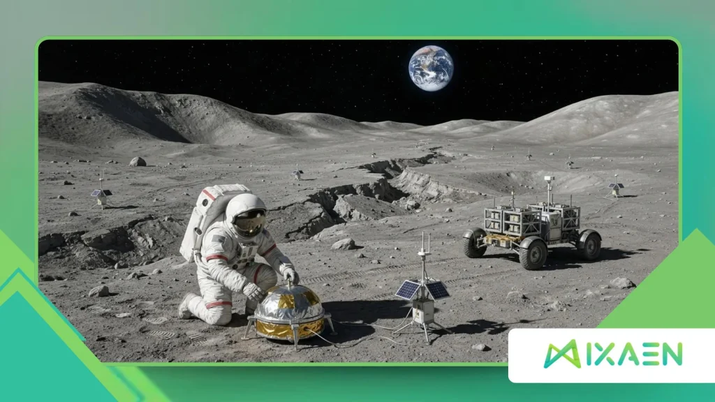
Lunar Seismic Monitoring sits at the center of a quiet revolution in space exploration as agencies and private ventures prepare for sustained operations on the Moon.
Decades after the Apollo astronauts left behind the first seismometers, planetary scientists are returning to the lunar surface with a sharper question: where will ground shaking pose real hazards to habitats, power grids, and landing pads?
A moonquake rarely topples a skyscraper the way a major terrestrial earthquake might, yet the Moon behaves very differently from Earth.
Without liquid water to dampen vibrations or dense atmosphere to scatter energy, ground waves can ring through dry, fractured rock for minutes or even hours.
Mapping those tremors before permanent bases take root is no longer a purely academic exercise. It is a practical requirement for keeping crews and infrastructure safe.
At a Glance: What This Guide Covers
- The seismic realities of the Moon: How shallow, deep, thermal, and impact-driven tremors differ in origin, duration, and hazard level.
- Sensor networks and measurement strategies: How modern seismometers, solar power systems, and multi-node arrays improve on Apollo-era coverage.
- Risk mapping for lunar infrastructure: How hazard maps guide site selection, structural engineering, and operational alerts for future bases.
- Key comparisons and reader answers: A side-by-side breakdown of moonquake categories, followed by practical answers to common questions.
Why Do Moonquakes Matter for Future Lunar Missions?
What kinds of moonquakes actually shake the lunar surface?
Planetary geophysicists classify natural lunar ground motion into four main types: deep moonquakes, shallow moonquakes, thermal moonquakes, and meteoroid impacts.
Deep moonquakes occur roughly 700 to 1,200 kilometers below the surface, driven largely by gravitational tidal stresses as the Moon orbits Earth.
Shallow moonquakes originate much closer to the crust often within the top 20 to 30 kilometers and can last significantly longer, sometimes exceeding ten minutes of sustained shaking.
Thermal moonquakes happen near sunrise and sunset when rapid temperature swings of more than 200 degrees Celsius cause the brittle outer regolith to expand and contract.
Meteoroid impacts add sudden kinetic shocks whenever space rocks strike a surface unprotected by a thick atmosphere.
Think of the Moon less like a solid bell struck once and more like a stack of dry ceramic tiles settling gently while ringing for a long time.
How did the Apollo seismic network shape what we know today?
Between 1969 and 1977, the Apollo Passive Seismic Experiment recorded more than 12,000 seismic events across four primary stations placed on the lunar near side.
Those instruments revealed that the Moon is seismically alive, though its energy release is far smaller than Earth’s largest earthquakes.
Most recorded tremors measured below magnitude 3 on local scales, yet even modest ground motion becomes consequential when paired with long ringing durations and loose surface soil.
The Apollo network also had clear blind spots because all stations sat relatively close together on the near side and eventually shut down in September 1977.
Scientists still rely on that historic dataset to infer interior layers, including a partial melt zone deep inside the mantle.
However, modern mission planners need wider geographic coverage, especially near the lunar south pole where water ice and rugged terrain attract intense exploration interest.
++ What MMX’s Idefix Rover Will Search for on Phobos
Which moonquake risks pose the greatest threat to habitats and equipment?
Shallow moonquakes draw the closest scrutiny from engineers because their energy concentrates closer to the surface where bases, rovers, and solar arrays operate.
Even a tremor that feels mild at first could trigger rockfalls along steep crater walls or destabilize loose slopes near shadowed craters.
Over months or years, repeated micro-vibrations can also loosen fasteners, shift dust seals, or stress rigid cabling linking power stations to habitats.
Consider two practical scenarios on the lunar surface. First, a robotic mining outpost operating near a steep crater rim faces slope-stability risks if a shallow thrust fault slips nearby.
Second, a solar power farm relying on long, high-voltage power lines could experience connector fatigue or alignment drift if subtle ground waves recur at predictable tidal intervals.
Could a seemingly minor shake disrupt a critical mission if engineers design strictly for static loads?
How Does Modern Seismic Monitoring Work on the Moon?
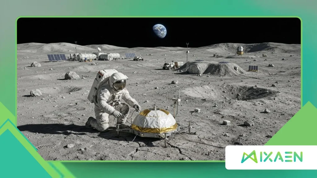
How do seismometers detect ground motion in a near-vacuum environment?
Lunar Seismic Monitoring relies on ultra-sensitive inertial sensors such as geophones and broadband seismometers that measure tiny relative movements between a suspended mass and the lunar ground.
Because the Moon has virtually no atmosphere, wind noise does not exist, which allows sensitive instruments to pick up delicate vibrations.
At the same time, extreme day-night thermal cycles challenge electronics, forcing engineers to insulate sensors, regulate heaters, and isolate cables from thermal expansion.
Unlike terrestrial stations connected by fiber-optic cables and mains power, lunar instruments must survive radiation, dust accumulation, and long lunar nights lasting roughly two weeks.
Designers pair compact sensors with autonomous power and data relays so seismic waveforms reach Earth reliably.
Placement matters just as much as sensitivity: setting a sensor on solid bedrock or anchoring it beneath loose regolith improves signal clarity dramatically.
++ How Hera’s CubeSats Will Study Dimorphos During Arrival
Why does a multi-station array beat a single lander sensor?
A single seismometer can tell you that the ground shook and roughly how strong the wave looked at one spot, much like hearing thunder without knowing where lightning struck.
A distributed network of stations across different latitudes and longitudes allows analysts to triangulate epicenters, estimate event depth, and separate local rock shifts from distant impacts.
Timing synchronization across nodes is essential so arrival-time differences reveal how seismic waves travel through varied crust thickness.
Lunar Seismic Monitoring becomes far more predictive when stations cover both flat plains and fractured highland terrain.
Differences in regolith depth and subsurface rock density can amplify or muffle ground motion from one site to the next.
By comparing simultaneous readings across multiple nodes, geophysicists can build local site-response profiles rather than assuming uniform shaking everywhere.
Also read: Why Cislunar Communications Matter Beyond Lunar Exploration
How will upcoming missions upgrade lunar seismic data collection?
Space agencies and commercial payload providers are advancing Lunar Seismic Monitoring through compact, low-power instruments designed to ride aboard robotic landers before crewed bases expand.
Instruments such as NASA’s Farside Seismic Suite aim to gather continuous data in quieter, previously unmonitored regions, expanding beyond the near-side footprint of the Apollo era.
Newer sensors also benefit from decades of miniaturization and digital telemetry that capture broader frequency bands with higher precision.
As more landers touch down over the coming decade, each new seismic node adds another reference point to the lunar map.
Combining orbital topography, gravimetry, and surface seismic logs helps researchers spot fault scarps and fractured zones that warrant closer study.
Over time, continuous monitoring shifts lunar geophysics from sporadic snapshots toward ongoing hazard tracking.
How Can Seismic Data Be Turned Into Risk Maps?
What information goes into a lunar seismic hazard map?
Building a practical moonquake risk map requires blending seismology with geology and structural engineering.
Researchers start with historical and newly recorded event catalogs to estimate how often different types of tremors occur in a given region.
They then layer in geological maps showing lobate scarps, faults, crater rims, and regolith thickness, alongside slope angles derived from high-resolution orbital imagery.
Engineers also factor in local amplification effects, since loose, unconsolidated regolith behaves differently from solid exposed rock.
By combining wave-propagation models with terrain data, planners can identify zones where ground motion may last longer or trigger secondary hazards like regolith slumping.
The result is a spatial guide that highlights safer landing corridors and areas requiring reinforced foundations.
How do engineers use risk maps to design safer lunar bases?
Once hazard maps identify where shaking is more likely or more prolonged, structural engineers can tailor designs to match those local conditions.
Flexible joints, shock-absorbing mounts, and wide, low-center-of-gravity landings reduce the chance that vibrations knock tall antennas or storage tanks off balance.
Site selection teams can likewise steer permanent habitats away from steep fault scarps toward flatter, geologically quieter terrain.
Lunar Seismic Monitoring also supports operational decision-making once crews and autonomous systems are active on the surface.
Automated alerts can pause sensitive precision tasks such as drilling, crane lifts, or delicate scientific alignments during active seismic swarms.
Over the long run, real-world sensor feedback lets engineers refine safety margins without over-engineering every component blindly.
What gaps still limit accurate moonquake forecasting today?
Despite strong progress, Lunar Seismic Monitoring still faces real scientific limits before anyone can issue pinpoint “moonquake warnings” like weather forecasts.
The Apollo dataset remains finite, and long-term baseline records do not yet cover every candidate landing zone around the lunar south pole.
Without dense, multi-year sensor coverage across diverse terrains, uncertainty remains around how frequently stronger shallow events strike specific faults.
Subsurface structure adds another layer of complexity because hidden fractures and varying regolith depths scatter seismic waves in intricate ways.
Closing those gaps takes patience, international data sharing, and sustained surface operations rather than a single mission.
Even so, every additional year of calibrated data narrows guesswork and strengthens mission planning.
Moonquake Types and Operational Implications
| Tremor Type | Primary Driver | Typical Duration | Main Operational Concern |
| Deep Moonquakes | Earth-Moon tidal stresses at great depth | Minutes; often recurring in clusters | Repeated low-level fatigue on long structures and cables |
| Shallow Moonquakes | Tectonic/crustal stress near surface faults | Often several minutes to over 10 minutes | Stronger surface shaking, rockfalls, and slope instability |
| Thermal Moonquakes | Extreme day-night surface temperature swings | Brief bursts around sunrise and sunset | Local regolith shifts and sensor or equipment clicks |
| Meteoroid Impacts | High-speed space rock collisions | Sharp onset with ringing coda | Sudden localized shockwaves and secondary ejecta |
Charting a Safer Path Across the Lunar Frontier
Sustainable exploration of the Moon depends on understanding the ground beneath our boots and beneath every lander, rover, and habitat module.
Lunar Seismic Monitoring turns invisible underground vibrations into actionable knowledge, helping mission planners pair scientific discovery with sound engineering.
By learning from Apollo’s historic records, expanding multi-station networks, and mapping terrain hazards early, explorers can build infrastructure suited to the Moon’s unique seismic rhythm.
Share your thoughts in the comments on which lunar regions or technologies you think deserve priority in upcoming missions.
Frequently Asked Questions
How strong are moonquakes compared with earthquakes on Earth?
Most moonquakes recorded during the Apollo era were relatively modest in magnitude compared with major earthquakes on Earth, rarely exceeding local magnitudes around 3 to 5.5 for the strongest shallow events.
What makes them notable is duration rather than sheer peak violence, as dry lunar rock can let vibrations ring for many minutes. For lunar habitats and precision hardware, sustained shaking still demands careful engineering.
Can a moonquake trigger a tsunami on the Moon?
No, because the Moon has no oceans, lakes, or liquid seas capable of generating water tsunamis.
Instead, surface hazards from strong shaking center on loose regolith movement, rockfalls along crater walls, and structural stress on surface installations.
Those localized effects can still disrupt equipment or access routes near steep terrain.
Why are shallow moonquakes studied so closely for base planning?
Shallow moonquakes originate closer to the surface than deep tidal moonquakes, meaning their energy reaches surface structures more directly.
Several historic shallow events lasted unusually long and occurred in regions with fault features. Understanding where and why they happen helps engineers choose stable sites and design resilient foundations.
How many seismometers were placed on the Moon during the Apollo program?
Apollo missions deployed passive seismometers across four primary stations Apollo 12, 14, 15, and 16 alongside an earlier unit on Apollo 11 that operated for a shorter period.
Together, the four long-running stations collected seismic data into late 1977 before being turned off. Their recordings remain the foundational baseline for lunar seismology.
Will future lunar bases need continuous seismic monitoring?
Yes, continuous seismic monitoring will be valuable throughout the life of a lunar base, much like seismic networks support infrastructure in active regions on Earth.
Ongoing data helps verify structural health after tremors, refine local risk maps, and distinguish natural ground motion from vibrations caused by mining, landings, or machinery.
